|
| *****SWAAG_ID***** | 192 |
| Date Entered | 17/05/2011 |
| Updated on | 17/05/2011 |
| Recorded by | Tim Laurie |
| Category | Geological Record |
| Record Type | Geomorphology |
| Site Access | Public Access Land |
| Record Date | 16/05/2011 |
| Location | In pasture above Clints Lead Mine. |
| Civil Parish | Marske |
| Brit. National Grid | NZ 094 029 |
| Altitude | 305m |
| Geology | Boulder clay over Main Limestone. At line of shake holes which denote the upper limit of the outcrop of the Main Limestone.
|
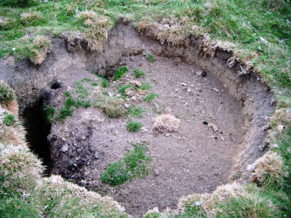
| Record Name | Birth of a swallow hole or shakehole. Clints lead mine. |
| Record Description | Swallow holes like this can appear at any time and are are formed where surface water erodes boulder clay overlying limestone at the point where the surface water enters enlarged joints in the limestone strata, at the line of the limestone
outcrop. Quad bikers beware!
Depending on the depth and angle of repose of the boulder clay, swallow holes can grow to substantial dimensions. These features may indicale the location of a pothole in the underlying limestone. |
| Dimensions | 4m diameter approx. Depth unknown! |
| Image 1 ID | 659 Click image to enlarge |
| Image 1 Description | Birth of a swallowhole or shakehole. |  |